Support
Add a new pipeline segment to a project by uploading a KML or KMZ file containing the route.
Getting started
- From the Pipeline Design page, click 'Add Pipeline Segment.'
- Fill in the segment name, description, material, and diameter.
- Drag your KML or KMZ file onto the upload box (or click it to browse), then click 'Create Pipeline Segment.'
If your file has more than one line
KML/KMZ files often contain more than one line — reference lines, draft versions, or alternate routes are common. If your file has more than one usable line, you'll be shown a list to choose from before continuing:
- Each line shows its length, and if the file organizes placemarks into folders, the folder name is shown too — handy for telling similar-looking lines apart.
- Lines with identical geometry elsewhere in the file are flagged 'Duplicate,' so you don't accidentally add the same route twice.
- Check one line, or several, then click Continue. Checking more than one combines them into a single segment.
How merging works
When you select multiple lines, they're joined end-to-end wherever they share an exact connecting point. If some of the selected lines don't connect exactly (for example, if they were drawn as separate, unconnected pieces), the app automatically works out the order and direction that keeps the total gap between them as small as possible, then bridges any remaining gap with a straight connector line. If any connectors were needed, you'll see a warning on the next screen showing how many gaps there were and their total length — when you see this, review the merged route carefully before finishing, and go back to reselect if the combination doesn't look right.
Verifying the segment
On the verification screen, check the station 0+00 direction and total length.
- Click 'Reverse Station 0+00' if the direction should be flipped.
- Click 'Verify Station 0+00 Location' to finish, or 'Cancel Segment Setup' to abort and delete the in-progress segment.
Tips
- Only lines at least 10 ft long are shown in the picker — short stray points get filtered out automatically.
- If you see a 'Duplicate' flag, you likely only need one of the two — selecting both just retraces the same path twice.
- Naming your placemarks and organizing them into folders before exporting from Google Earth makes them much easier to tell apart in the picker.
- A gap warning doesn't mean something is broken — it just means the selected lines weren't drawn touching each other. Double-check the merged route makes sense before finalizing.
The difference between a .kmz and .kml file is that .kmz files are the "zippped” version of a .kml file.
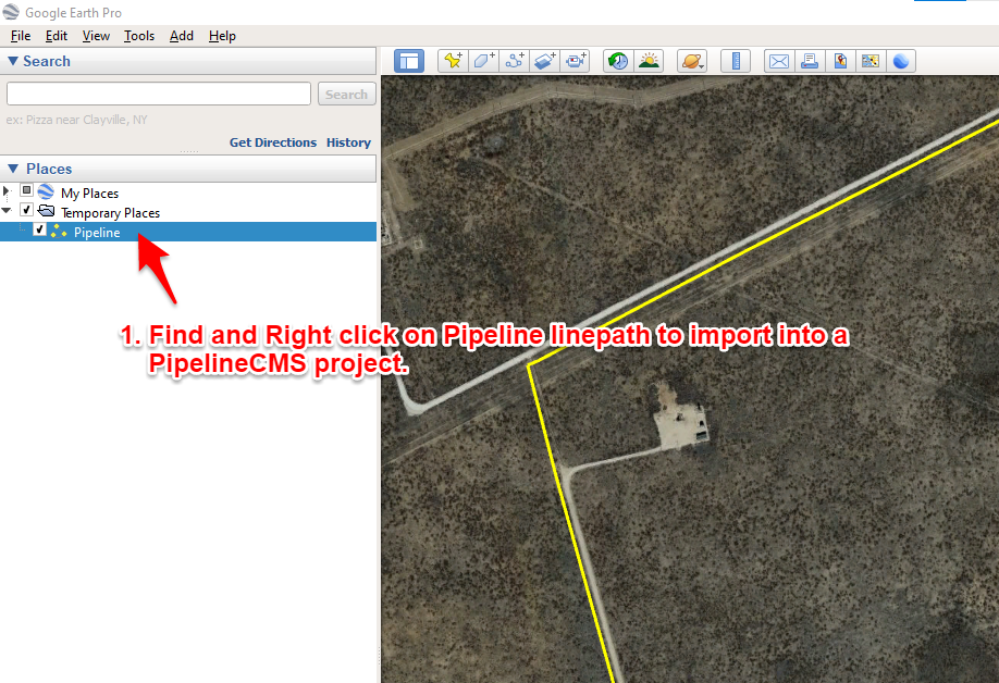
To get started, you’ll need to go to the left sidebar in Google Earth and select the path (pipeline centerline) that you want to export and save.
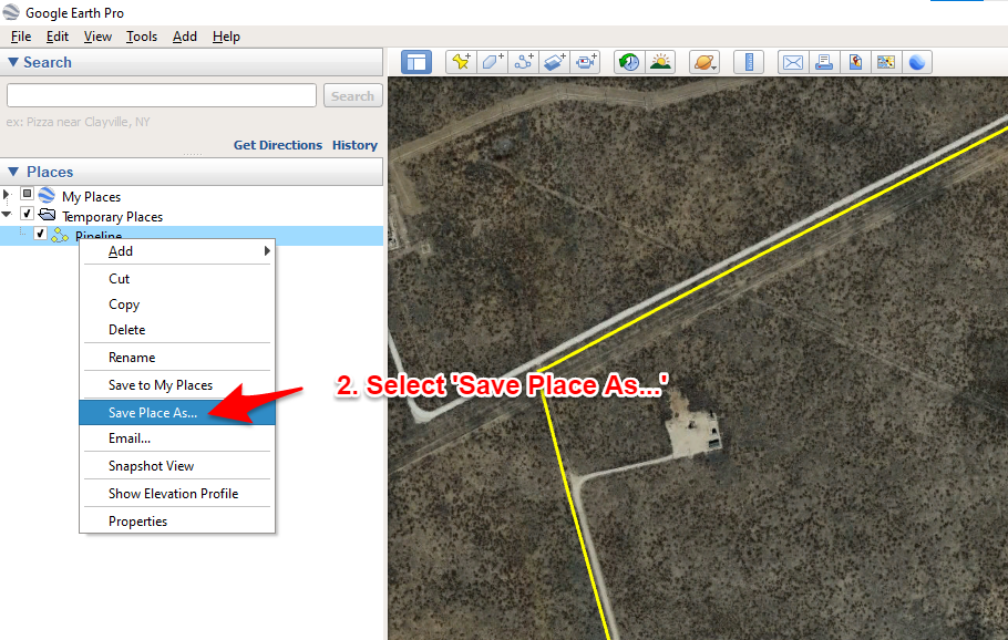
Once it is selected, then right-click (or on a Mac, “command-click”) and then choose “Save As . . .”
You’ll then be presented with a dialogue box allowing you to choose the file type ( Select .kml), file name, and the location.
Set those and click on the 'Save' button.
Back on the Pipeline Project - Setup screen, click the 'Browse' button to locate and select the .KML file you just created.
Now you can select the 'Create Pipeline Project' button to continue.


- Telephone
- (432)638-7448
- info@pipelinecms.com
Pipeline CMS is built and operated by Square Top Ventures, Inc. © 2026. All rights reserved.
